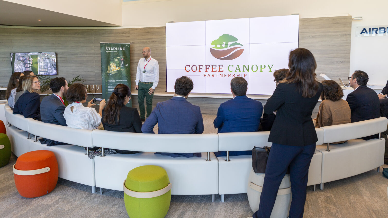
Coffee sector leaders launch first global mapping initiative
The Coffee Canopy Partnership was launched today to advance the identification and remediation of coffee-related deforestation.
Initiated by JDE Peet’s (now part of Keurig Dr Pepper), and developed in collaboration with leading coffee companies including Louis Dreyfus Company, Sucden, Neumann Kaffee Gruppe, Touton, Sucafina, and Tchibo, the Partnership will create the world's first comprehensive, openly-accessible map of global coffee production to identify deforestation risks, support landscape restoration and protect the livelihoods of millions of smallholder farmers.
Using Airbus's advanced satellite technology, the Partnership will map coffee farms across coffee-growing landscapes, identify areas of forest loss, and work with governments to restore landscapes and prevent future deforestation.
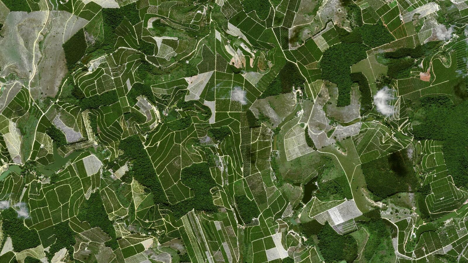 The Partnership initiative launches with an East Africa pilot covering Ethiopia, Tanzania, Kenya, Uganda, Burundi and Rwanda – mapping 1.2 million square kilometres of coffee landscapes. Building on the pilot's success, the Coffee Canopy Partnership will aim to achieve worldwide coverage of all coffee-growing regions in 2027 through expanded industry and institutional co-investment.
The Partnership aims to support coffee-related deforestation remediation efforts over time, subject to the availability of validated data and in collaboration with governments and local communities, with the objective of contributing to landscape restoration and reducing future forest loss. The pilot phase of the initiative is supported by the UK Foreign, Commonwealth & Development Office (FCDO) and endorsed by the UN Food and Agriculture Organisation (FAO).
Laurent Sagarra, VP Engagement at JDE Peet’s, said:
“A sustainable coffee industry is one in which coffee production no longer contributes to forest loss. To help advance this vision, we are launching the Coffee Canopy Partnership. The Partnership is designed to move beyond fragmented, company-led deforestation initiatives by fostering collaboration at a landscape scale – supporting efforts to map and safeguard coffee-growing regions, not just individual supply chains. This is not another certification scheme; it is a sector-led initiative aimed at strengthening collective action to help keep forests vibrant and reduce the risk of coffee-driven deforestation over time. We warmly invite all players in the coffee sector to join us.”
Eric Even, Head of Space Digital at Airbus Defence and Space, said:
“Leveraging our very high-resolution Pléiades and Pléiades Neo satellite imagery combined with advanced AI capabilities, Airbus helps identify deforestation risk and protect our world’s forests, while simultaneously empowering food producers and smallholder farmers with the transparency and reliable data needed to strengthen their resilience and build a truly sustainable supply chain.”
A transformative approach to sustainable coffee
Under the EU Deforestation Regulation (EUDR), coffee grown on land classified as forest after December 2020 may not enter EU markets. This threatens to exclude millions of smallholder farmers from key markets, despite their sustainable farming practices, simply because existing maps incorrectly classify their agroforestry or shade-grown coffee production land as forest.
In this context, the Coffee Canopy Partnership addresses a fundamental challenge within the sector: the historical lack of precise mapping data, which has frequently resulted in coffee farms – specifically shade-grown and agroforestry systems – being misidentified as natural forest. By leveraging sophisticated high-resolution satellite imagery (up to 30cm resolution), combined with artificial intelligence and on-the-ground verification, the Partnership will establish two definitive datasets:
- A 2020-2021 baseline map showing the true extent of coffee cultivation, correcting widespread misclassifications of coffee agroforestry systems as forest.
- A 2024-2025 updated map to support the identification of potential new coffee production land and areas where forest change has occurred since 2020.
These maps are planned to be integrated into a transparent, openly accessible geospatial platform, designed to enable farmers, governments and the coffee industry to access data that can support sustainability planning and forest protection.
Statements from Partnership Members & supporting institutions include:
Joseph Larrose, Deputy Managing Director – Sustainability, Supply Chain, Innovation & Communication, Touton, said: “We are proud to join forces with our peers and Airbus in the Coffee Canopy Partnership. At Touton, we believe that trust, shared responsibility and innovation are essential to building a deforestation-free coffee sector. With strong roots in East Africa, we see the critical importance of a common, science-based mapping reference recognised by producers, governments and industry alike. It strengthens the robustness of our data, supports compliance, and enables effective collective action on the ground. This partnership is also a key milestone in delivering on our commitment to no deforestation by 2035.”
Kate McCoy, Director, Partnerships for Forests (P4F), said: “Partnerships for Forests, funded by UK International Development, is proud to help launch the first phase of the Coffee Canopy Partnership, alongside the other consortium members. Our support is helping to set up an open and transparent monitoring platform to verify deforestation free coffee production. Phase one will deliver clear, accurate maps showing where coffee is grown and where forests are under pressure across six East African countries – including P4F priority countries in the region – Ethiopia, Kenya, Uganda and Tanzania. By creating this shared foundation, we are developing a proof of concept that can then be scaled globally to help the whole sector move towards a unified, landscape level approach that protects forests and improves market access for farmers.”
Julian Fox, Team Leader on Forest Monitoring, UN Food and Agriculture Organization (FAO), said: “The initiative led by JDE Peet’s and Airbus is well aligned with the AIM4Commodities program (Accelerating Innovative Monitoring for Forests and Commodities), through which FAO promotes transparent and sustainable commodity production, encouraging sector-wide transformations toward open and inclusive data and technical solutions, protecting forests whilst leaving no one behind.”